Madaba Map
Doctrinal reflection
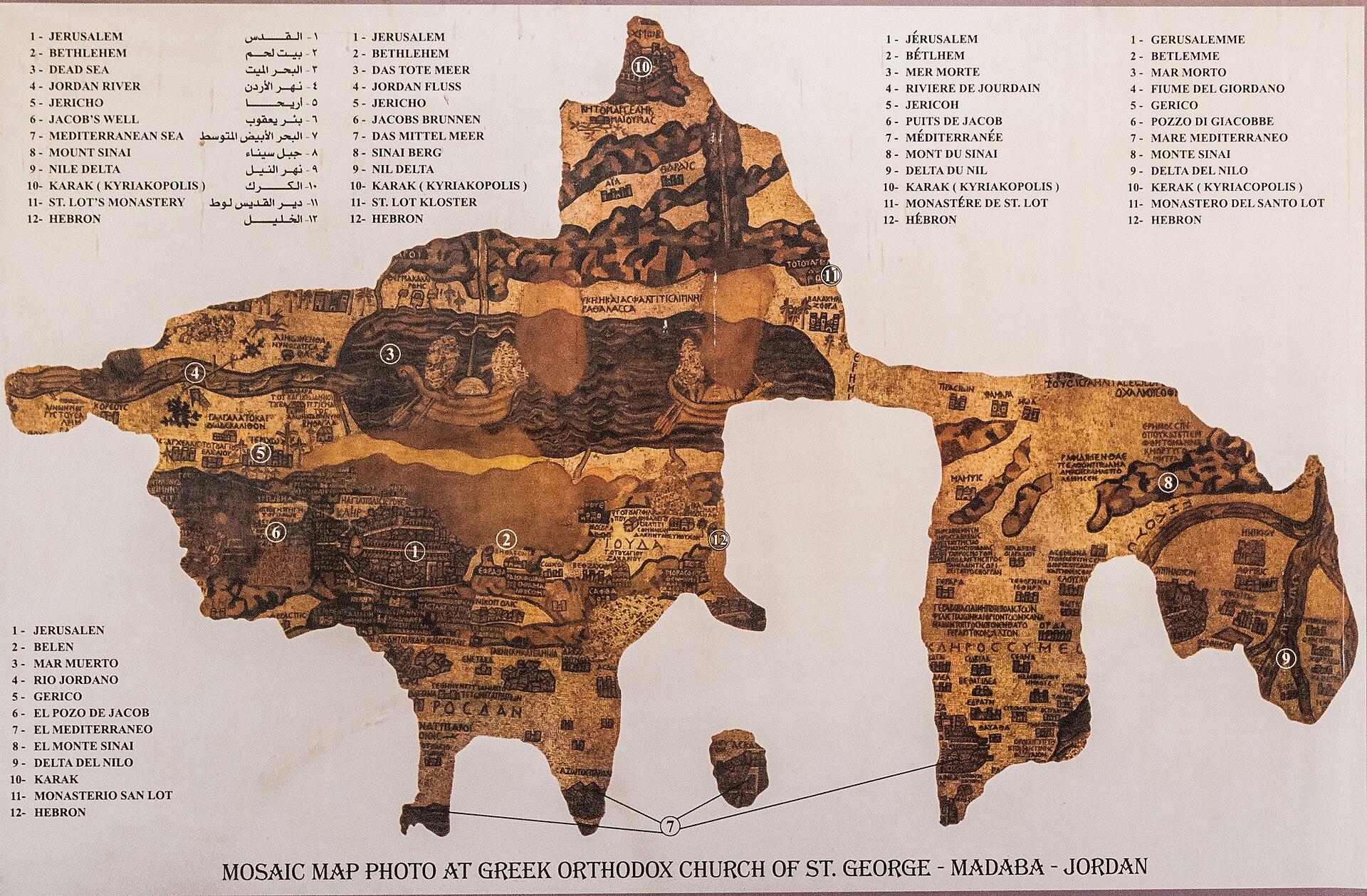
The Madaba Map is a floor mosaic preserved in situ in the Church of Saint George, Madaba, Jordan, dated to approximately AD 560–565 on the basis of stylistic analysis and the historical context of Byzantine cartographic production under Justinian I. Originally measuring an estimated 21 by 7 meters, the surviving fragment retains roughly a third of its original surface, depicting the geographic extent of the Holy Land from Lebanon and Syria in the north to the Nile Delta in the south, and from the Mediterranean coast eastward into Transjordan. Executed in tesserae of glass and stone, the mosaic employs a top-oriented north and integrates over 150 toponymic inscriptions in Greek, correlating sites with biblical narrative and contemporary ecclesiastical topography. Jerusalem occupies the cartographic center in a detailed bird's-eye schematic, identifiable by the colonnaded Cardo Maximus, the Church of the Holy Sepulchre rendered with distinctive red roofing, and the New Church of the Theotokos (Nea Ekklesia) commissioned by Justinian in AD 543. The theological program is explicitly typological: the map visualizes sacred geography as the spatial substrate of salvation history, directing the viewer's gaze from the earthly landscape toward its scriptural and eschatological significance. Scholarly debate centers on its cartographic sources—whether dependent on the Tabula Peutingeriana tradition, Eusebius's Onomasticon, or independent pilgrimage itineraries—as well as on the identity of its patron. The mosaic remains indispensable for reconstructing sixth-century urban topography of Jerusalem and the broader Levant. Sources: Dumbarton Oaks Papers; Journal of Roman Archaeology; Israel Exploration Journal.